What we’re into: Oregon Geographic Names
Published 12:00 pm Monday, February 21, 2022
- Oregon Geographic Names
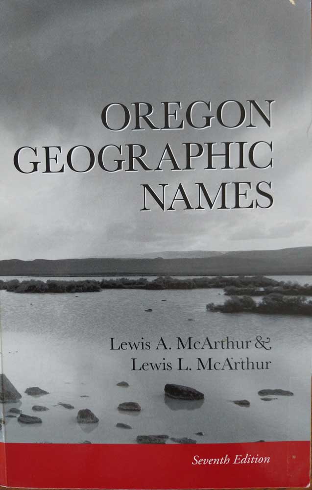
One of my favorite references to reach for when I want to do a little armchair exploring is “Oregon Geographic Names,” a magnificent doorstop of a book that captures not only the nuts-and-bolts details of thousands of Oregon place names but a great deal of the state’s history and romance as well.
Trending
The first edition, compiled by Lewis A. “Tam” McArthur, came out in 1928. My copy is the seventh edition, published in 2003, with McArthur’s son Lewis L. listed as co-author.
It runs 1,070 pages, from A B Crossing (a defunct railroad station on the old Southern Pacific Coos Bay Line south of Coquille) to Zwagg Island (a small landmass just offshore from Brookings that bears the name of a Dutch hermit).
Since moving to John Day last fall, I’ve consulted it several times to satisfy my curiosity about Grant County place names. Like the county itself, named for Ulysses S. Grant, the leader of the Union armies (and later president), many of the county’s place names date from the Civil War era.
Trending
Dixie Creek, which flows into the John Day River near Prairie City, got its name during the gold boom of the 1860s because there were so many Southerners mining along its banks. Not far away you’ll find Jeff Davis Creek, named after the president of the Confederacy. Rebel Hill in Canyon City was named for the Southern sympathizers who lived there “and made their presence very much noticed,” according to the McArthurs.
My favorite find so far, however, is Cheatem Holler Camp, southwest of Silvies near the Harney County line. It was named by Forest Service employee Leo Gunther for a local resident named Cheatum (or possibly Cheatham). As the McArthurs put it in their inimitable style, “An incident involving Mr. Cheatum, a bottle of whiskey, and an irate Mrs. Cheatum was responsible for Gunther’s terminology.”
— Bennett Hall, editor, Blue Mountain Eagle
Marketplace


-
eEdition

-

-
